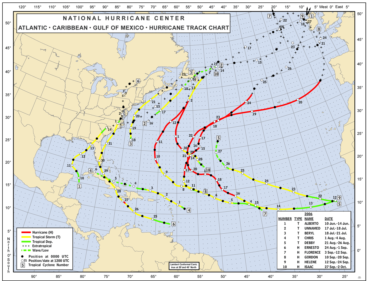
 Especially since El Nino went away (PDF), hurricane watchers have been worrying about what kind of season we'll see in the Atlantic later this year. El Nino has a well known tendency to suppress Atlantic storms, contributing to quieter years like 2006 (click image). But now, we're expected to see El Nino-neutral or even La Nina conditions (the opposite of El Nino) over the coming months.
The latest forecast from Tropical Storm Risk (PDF), a group based in the UK, only heightens the sense that we may have a bad year ahead.
TSR has now raised its forecast for an active season:
Based on current and projected climate signals, Atlantic basin and US landfalling tropical cyclone activity are forecast to be about 75% above the 1950-2006 norm in 2007. This is the highest March forecast for activity in any year since the TSR replicated real-time forecasts started in 1984. There is a high (~86%) likelihood that activity will be in the top one-third of years historically.
By the numbers, TSR is predicting 16.7 named storms, 9.4 hurricanes, and 4.3 intense hurricanes (Category 3 or higher). A rival group, that of William Gray and Phil Klotzbach of Colorado State University, had also predicted an active year back in December, but the CSU forecast--14 named storms, 7 hurricanes, and 3 intense hurricanes--did not go as far as TSR now has.
The next forecast from Gray/Klotzbach will be on April 3; the next one from TSR will be on April 5. The National Oceanic and Atmospheric Administration has not yet released a hurricane outlook for 2007; I believe the first NOAA forecast will come sometime in May.
A cautionary note: It's important to view these forecasts with a grain of salt--they get more and more accurate as the season nears, and especially once it's underway. Also, none of these three statistically based forecasts was very accurate during the pre-season last year due to the failure to detect El Nino. Still, the picture they're painting is worrisome...
- Log in to post comments
More like this

Any idea when the long-heralded ECMWF model predictions are going public?
Steve,
I couldn't say, but I sure would like to know what they're predicting right now....